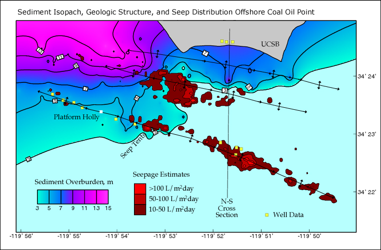
An isopach map depicts areas showing isopachs, or lines that represent equal thickness of a particular geologic feature, usually rocks. The map above shows the geologic structure of a certain area used to extract oil. The lines drawn are isopachs, or similar thickness of the ground sediment, which are important to understand when drilling for oil.
No comments:
Post a Comment